DeKalb · Clayton · Henry counties · The I-675 side of Atlanta
The Ellenwood City Guide
Quiet family neighborhoods, an interchange at the corner of I-675 and I-285, and one of the easiest airport commutes in metro Atlanta, with no city hall to speak of.
The Ellenwood City Guide covers what to know, getting around, restaurants, parks, shopping, schools, and local businesses in this unincorporated south metro community.
What to know
An unincorporated community with an interstate address
Ellenwood is not a city. It is an unincorporated community that spans the corners of DeKalb, Clayton, and Henry counties (parts of the 30294 address map also touch Rockdale), with the services that shape a real life here split the same way. There is no Ellenwood mayor, no Ellenwood city council, and no city utility bill. What Ellenwood has is a location that does heavy lifting: it sits on I-675 and Georgia 42, minutes from the junction where I-675 meets I-285, and roughly 15 to 20 miles southeast of downtown Atlanta.
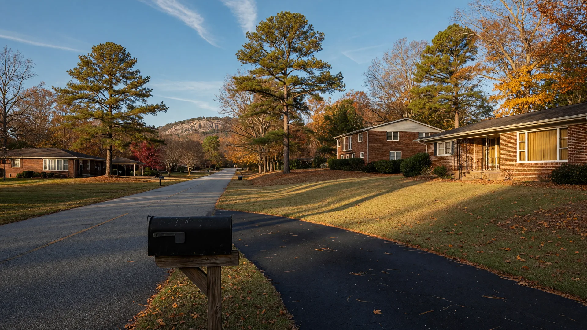
The character is uncomplicated: treed, mostly brick neighborhoods on quiet streets, pockets of older ranch homes and newer subdivisions, a working logistics side around the former Fort Gillem property, and the granite dome of Panola Mountain rising at the eastern edge. It is the kind of place people pass through on the way to somewhere else and then quietly end up buying a house in.
Location
On I-675 and Georgia 42, near the I-675 / I-285 junction. I-20 runs to the north.
Government
Unincorporated. County services, taxes, and schools follow the county your address is in, DeKalb or Clayton for most lots.
Airport run
Hartsfield-Jackson Atlanta International Airport is about 15 minutes by car in normal traffic, one of the closest ZIPs in the metro.
Outside the door
Rex, Morrow, Stockbridge, Lake City, and Forest Park ring the area, and Panola Mountain State Park sits at the eastern edge.
Is Ellenwood a city?
No. Ellenwood is an unincorporated community with a widely recognized name and ZIP code (30294) but no municipal government. County government is the local government, which is the honest answer to most "who do I call" questions here.
Which county is Ellenwood in?
It depends on the address. The community spans DeKalb and Clayton counties mainly, with Henry and Rockdale lines close by. DeKalb County covers most of the 30294 Zip, so verify the county on the specific lot before you assume anything about schools or services.
How far is Ellenwood from downtown Atlanta?
Roughly 15 to 20 miles southeast, about 25 to 35 minutes by car in normal traffic. The airport and the I-75 and I-285 job corridors are the closer draws for most commuters.
Moving to Ellenwood
The unincorporated checklist before you pick an address
Because there is no city government, nearly everything starts with the county on the deed. Confirm the county for the lot (DeKalb or Clayton for most addresses), then let the school district and utility providers for that county shape the rest of the plan. Water, sewer, fire, EMS, permitting, and property taxes all route through the county system, and what is county-run varies between DeKalb and Clayton.
- Verify the county and school attendance line for the exact address before you buy or rent.
- Expect a car for everything: the daily loop runs on county roads, I-675, and Georgia 42.
- Grocery, pharmacy, and most errands are inside ten minutes along Anvil Block Road, Fairview Road, or the GA 42 frontage.
- The airport and the I-285 and I-75 job rings are the commuter draws; time them at rush hour before you commit.
Getting around
I-675 is the main street: it runs through Ellenwood, connects north to I-285 and south toward I-75, and Georgia 42 (Macon Highway) does the local frontage work. MARTA runs buses into the area, and the nearest rail is at College Park and the airport. The full roads, transit, and commute picture lives on its own page.
Getting around Ellenwood: roads, transit, and commutesRestaurants and local food
Real tables in the Ellenwood orbit
Ellenwood's dining map is mostly chain frontage along Anvil Block Road and GA 42, with a handful of independent rooms worth the detour. These are real, open places; hours change, so check before you go.
Tookes Country Bar-B-Que
On GA 42, at the Rex side
A longtime smokehouse on the Macon Highway frontage, a few minutes from Ellenwood proper and a local name worth quoting for anyone who asks where to eat here. tookesbbqatl.com
1111 Sport Bar and Grill
3056 Anvil Block Road
The neighborhood sports bar and grill at the Anvil Block strip: wings, burgers, and the televisions, the closest thing Ellenwood has to a local room. 1111sportsbar.com
The Great American Hot Dog House
5246 Bouldercrest Road
A small independent counter on the Bouldercrest side serving hot dogs, burgers, and the everyday lunch crowd, the kind of place chains have not yet squeezed out.
Sweet Sadie May's
6080 GA 42, at the Rex side
A small-batch dessert counter and café on the same Macon Highway frontage, worth naming for the cakes and the coffee stop.
The reliable chains are here too: Waffle House, Popeyes, Wendy's, Zaxby's, and McDonald's along Anvil Block Road and Forest Parkway, plus American Deli for the wing-and-sandwich run. Hours and status change, so check before you visit.
Parks and outdoors
The granite dome and the county greens
The outdoors case for Ellenwood is stronger than most suburbs its size, because a legitimate state park and a National Natural Landmark sit at its eastern edge.
Panola Mountain State Park
At Ellenwood's eastern edge
A state park built around a granite monadnock, a National Natural Landmark and part of the Arabia Mountain National Heritage Area. Ranger-led summit hikes, wooded trails, and the quiet version of Stone Mountain's geology. gastateparks.org
Arabia Mountain National Heritage Area
North on the Rockdale and DeKalb side
The same granite landscape as Panola, with Arabia Mountain's summit trail and the surrounding preserve, a short drive north and a full day out with the family.
Village Park
In Ellenwood, on the Henry County side
The local park on this side of the map: a splash pad in season, trails, picnic space, and soccer fields, and one of the few built gathering points genuinely inside the Ellenwood name.
Reynolds Nature Preserve
In Morrow, minutes west
A Clayton County preserve of forest, trails, and a small lake just west of the Ellenwood line, run by Clayton County Parks and Recreation, good for a walk-after-dinner that feels farther from the interstate than it is.
Panola Mountain Golf Course sits on County Line Road in the Ellenwood 30294 and rounds out the recreation map. Hours and trail conditions are season-dependent; confirm before you drive.
Shopping
Errands first, retail runs a short drive away
Grocery and daily needs
Ingles Markets on Fairview Road, Kroger at the Fairview Oaks center next door, and the Walmart Supercenter on Anvil Block Road cover the daily loop without leaving the community. Pharmacies ride along with the grocery anchors.
The bigger retail runs
The malls and big-box rows of the south metro are a short drive in three directions: Morrow and Forest Park along GA 54, Stockbridge up the Henry side, and the Southlake and Stonecrest areas off I-285 and I-20.
Schools
Two districts, one address check
The 30294 address map splits between the DeKalb County School District and the Clayton County School District. Most of Ellenwood feeds DeKalb, where the area's high school is Cedar Grove High School on River Road. Addresses on the Clayton side feed Morrow-area schools, including Morrow High School. The honest rule carries every school question here: the boundary, not the ZIP, is the answer, so verify the exact attendance line for the lot before you buy or rent.
DeKalb County School District
Serves most Ellenwood addresses. Cedar Grove High School at 2360 River Road is the area's high school; the elementary and middle schools follow the cluster boundary for the street.
Clayton County Public Schools
Serves the portions of Ellenwood's 30294 that fall in Clayton County, feeding Morrow-area schools. Same rule, different district: the lot determines the school.
Local businesses
The independent rooms that make the map feel local
Beyond the chains, Ellenwood's independent side runs on a small set of names: the barbecue smokehouse, the sports bar, the hot dog counter, the cake café. If you need to reach one of these businesses or want a recommendation tuned to your night out, send a note here and it gets routed straight to the right door. No phone numbers or emails are published on this page, on purpose.
Tookes Country Bar-B-Que
GA 42, Rex side
Smokehouse barbecue on the Macon Highway frontage.
1111 Sport Bar and Grill
Anvil Block Road
Neighborhood sports bar, wings, and the game on.
The Great American Hot Dog House
Bouldercrest Road
Independent counter for hot dogs and burgers.
Sweet Sadie May's
GA 42, Rex side
Cakes, desserts, and the coffee counter.
Reach a local business
Tell us which business and what you need, and the note goes straight to the right door, no phone numbers or emails published here.
Community and events
A community that runs on county parks and neighbor power
Without a city government, there is no Ellenwood festival calendar to recite, and the honest version of this section says so. The gathering life happens at the county facilities and the neighborhood spaces: Village Park's splash pad and fields, the programming of nearby Forest Park and Morrow, and the church and school events that anchor the neighborhood calendar.
The Fort Gillem redevelopment story
The former U.S. Army depot at the community's western edge closed in 2011 and is being redeveloped as the Gillem Logistics Center, a large industrial and distribution campus on the Forest Park side. It is the biggest single local story for jobs and traffic, and it shapes the southeast corridor Ellenwood sits on.
Neighbor towns carry the calendars
For a dated event, look to the incorporated neighbors: Stockbridge, Morrow, Forest Park, and Jonesboro all run their own festivals, farmers markets, and holiday events within a ten-minute drive, and the regional events page keeps the ones with confirmed dates.
Real estate in Ellenwood
Buyers here are really choosing two counties
Real estate in Ellenwood is a county question first. Most inventory falls on the DeKalb side of the line, where the school district and county services follow DeKalb, and a meaningful share sits in Clayton. Homes lean toward mid-century brick ranches on treed lots and newer subdivisions, and the airport, I-285, and the Gillem distribution jobs keep demand steady from commuters. There are no listings on this page and no stats to recite; values and school lines are address-specific, and that is exactly why the honest advice is to check the lot before the neighborhood.
Rob Dietrich, REALTOR® · Georgia Real Estate License #384162 · eXp Realty, LLC · Equal Housing Opportunity. All real estate brokerage services are provided through eXp Realty, LLC. Information is believed to be accurate but is not guaranteed.